VGI Map Progress
Progress on the VGI map
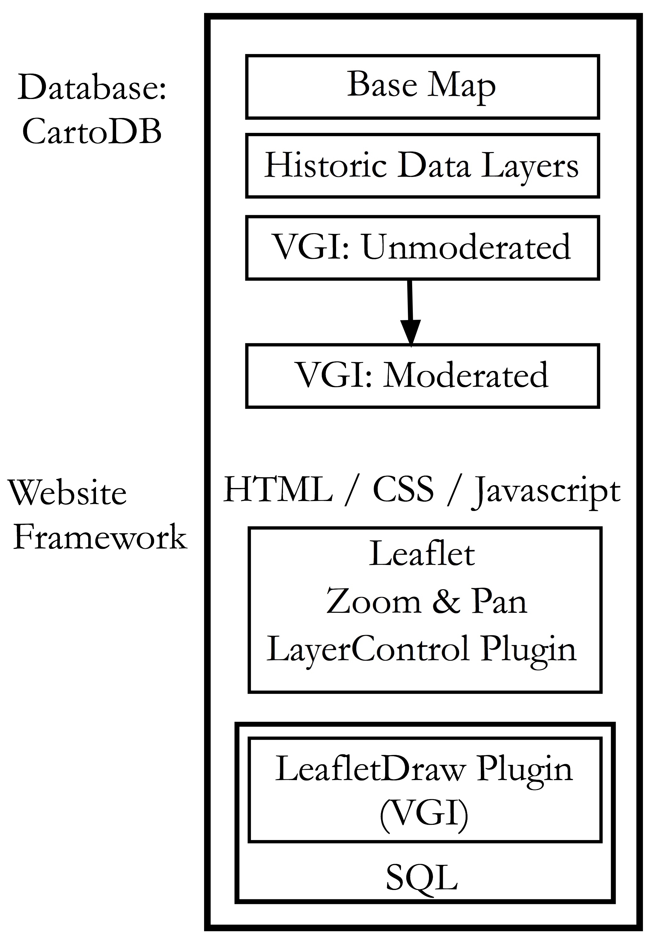
The broad goal of this project is to create a scalable, easy to deploy map that enables user input of point, line and polygon into a DB that supports some level of moderation. In addition, the UI will support layer control, pan and zoom. While these elements are available though the Leaflet JS library (and it only makes sense to use this library) there isn't a "ready to deploy" iteration of this build for someone who cannot code in JS. As such, I think that there is a need for researchers, or PPGIS geeks like me. Please see below for a stack concept.
Within this context, I am asking for help from the broader developer community, and specifically those geonerds with the right skills, by way of GitHub. I have created a VGI Project repo on GitHub with some project parameters, wireframes and a base template (shamelessly stolen from CartoDB), and I will be working with Zachary Schoenberger to fill out more details. My plea:
- Help with the project parameters and management;
- Poke holes and generally make suggestions on what can be better;
- Contribute code.
What do you think?